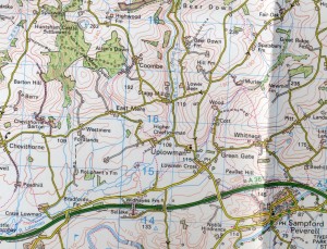
Map of Uplowman
The Parish of Uplowman, situated four miles north-east of Tiverton, is at the heart of a scattered rural Parish of 1200 hectares. The River Loman, rising in Somerset, passes through the village and merges with the River Exe at Tiverton before running to the sea at Exmouth.
The centre of the village is at Lowman Cross where there is a post office, pub and village hall, and nearby St. Peter’s Church. A short distance away is Greengates and the local Primary school. More houses are to be found at Whitnage, a mile away, but there are several smaller locations that are within the Parish boundaries.
In total there are 129 properties and 279 on the electoral role. At the last MDDC estimate in 2012 there were 350 inhabitants of whom 89 were under 20 and 70 over 65.
